GSM Lecture Summary (23-March-2026)
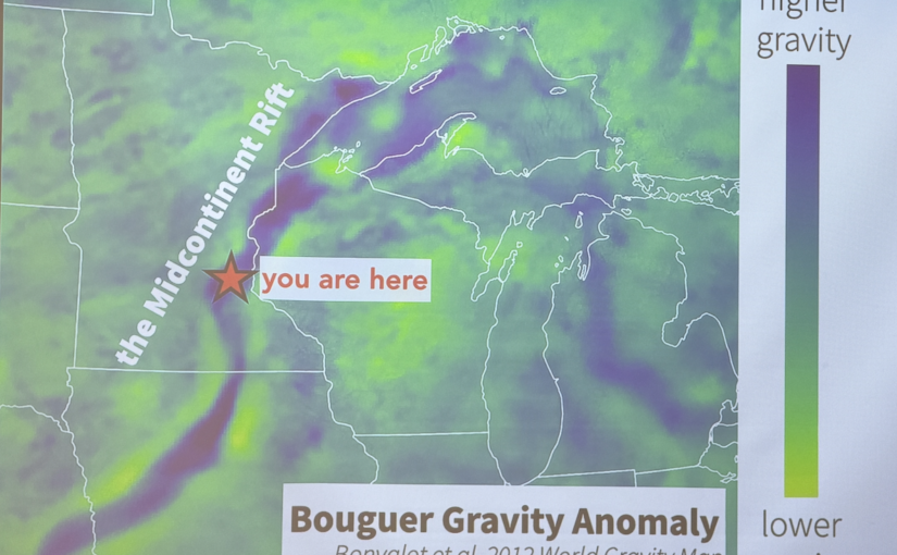
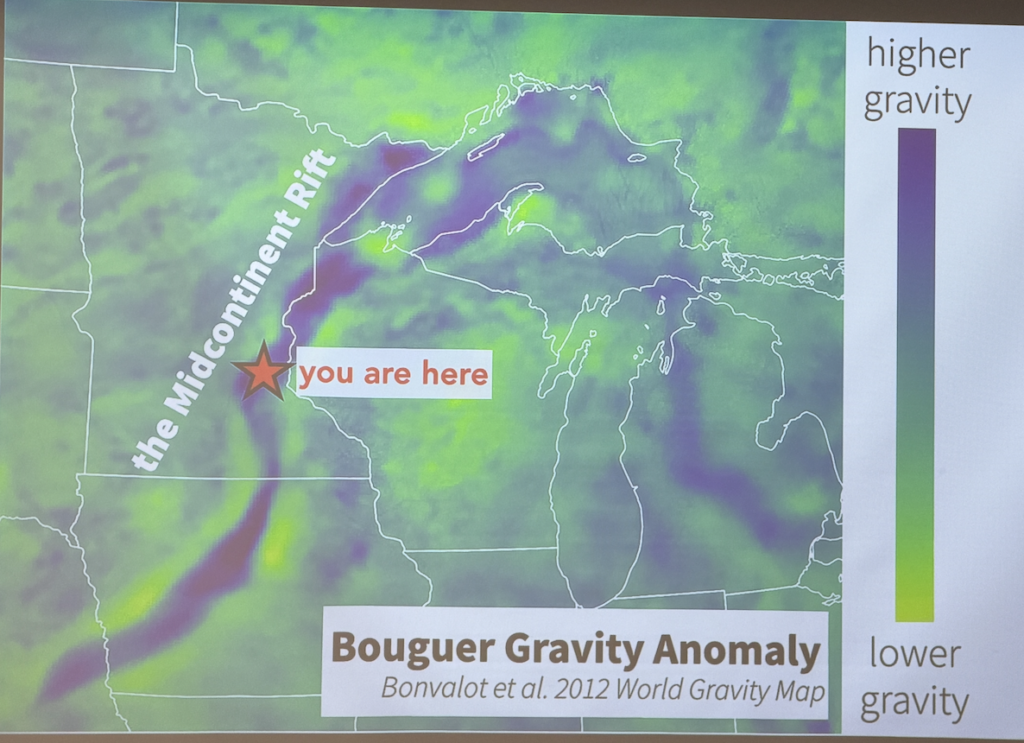
These are my notes from the 23-Mar-2026 GSM lecture on the Midcontinent Rift. The MCR almost split Laurentia (part of what is now North America) about 1.1 billion years ago. The MCR was about 2,000 miles long and produced a huge outpouring of lava, some of which is visible in the vicinity of Lake Superior; but most is buried below other rocks, and visible only via gravity anomalies and seismic reflection studies.
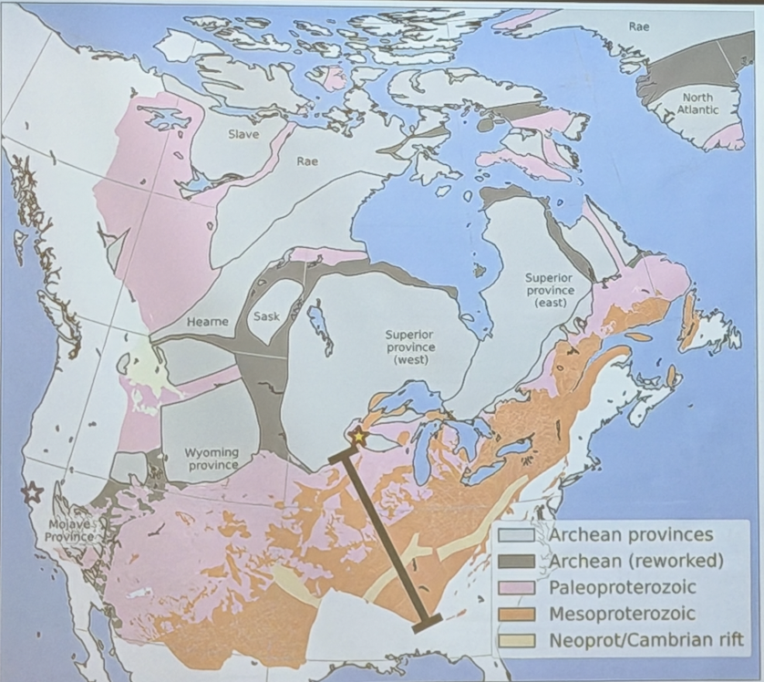
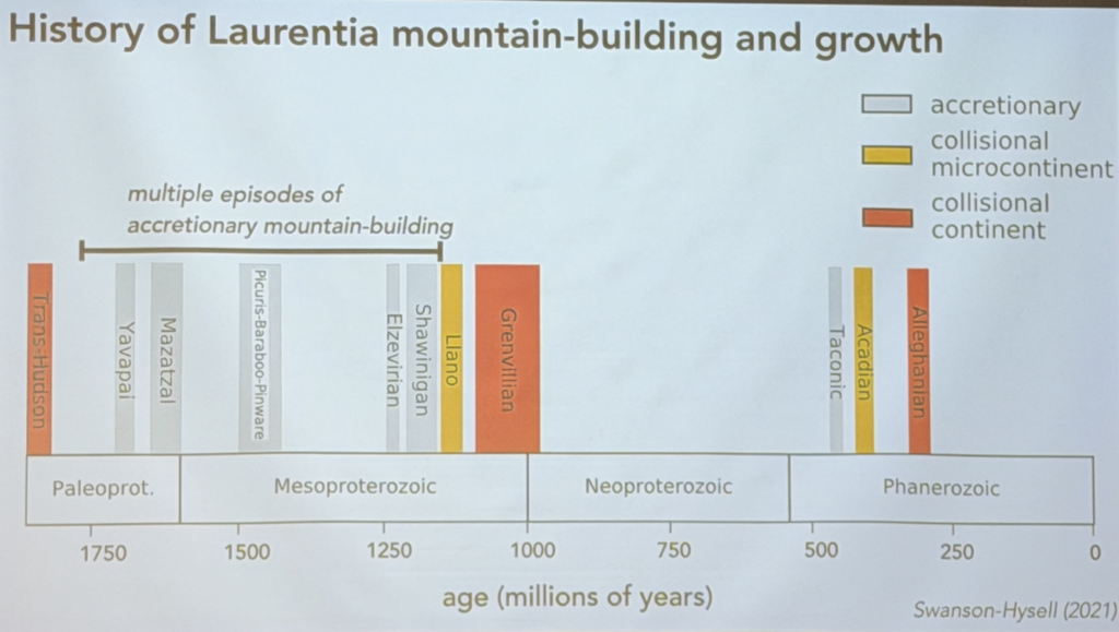
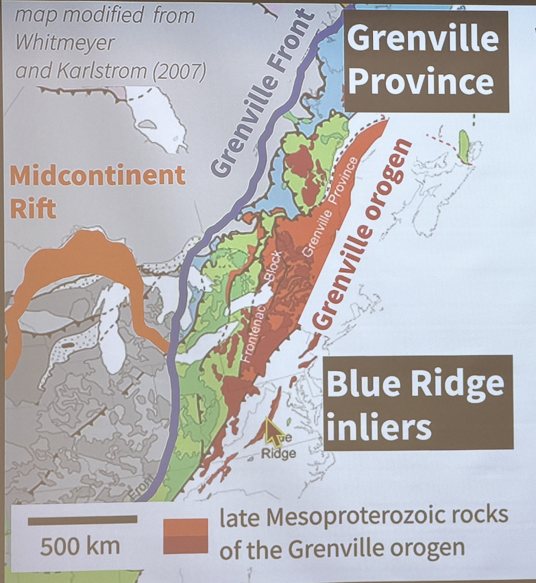
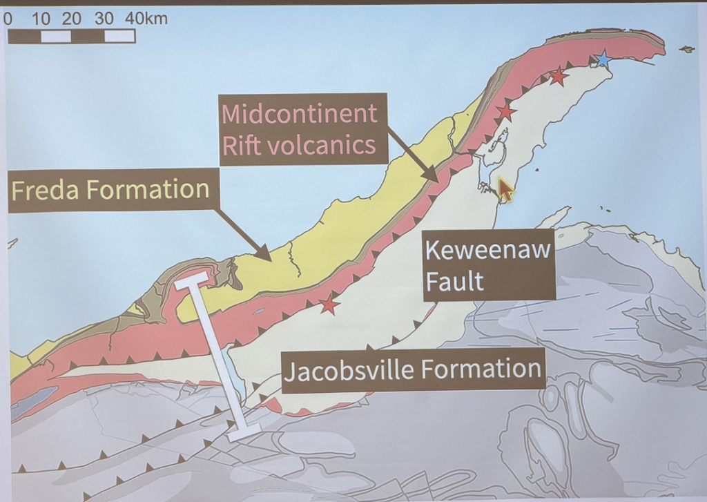
The lecture talked about the initiation of the rift, and in particular used paleomagnetic data to argue that the closing and inversion of the rift coincided with the collision of Laurentia with Amazonia and Kahlahari (two other ancient landmasses) that formed the supercontinent of Rodinia. There are also some nice maps of the Keweenaw peninsula which are the surface expression of some of the closing tectonics.
1. Before. Assembly of cratons that form core of Laurentia (now North America)
2. Overall: Afterwards Laurentia grew on two active margins—first south and east, and then (much later) west
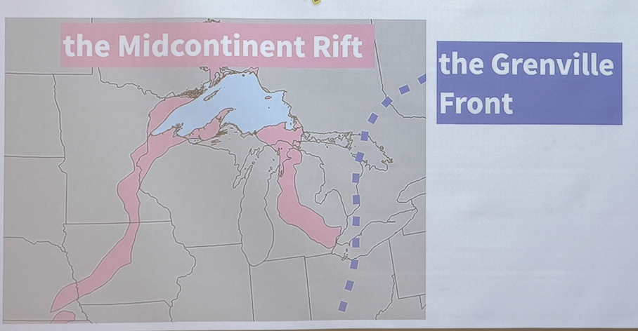
3. The rift as it is today
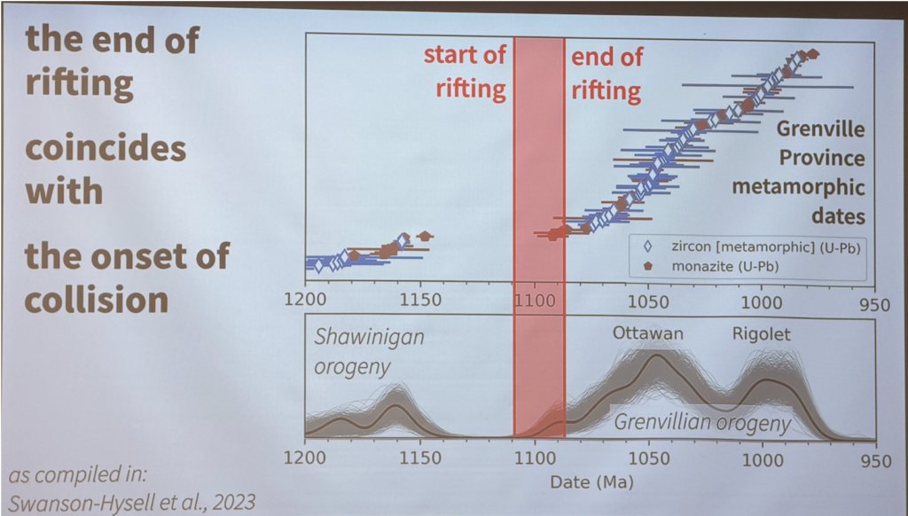
4. The beginning and ending of the rift per paleomagnetic data
4.1. Around 1.11 Ga Laurentia began to rift as it moved rapidly towards the equator, closing the Unimos Ocean; at this time it developed a central graben, accompanied by massive volcanism (see 5).
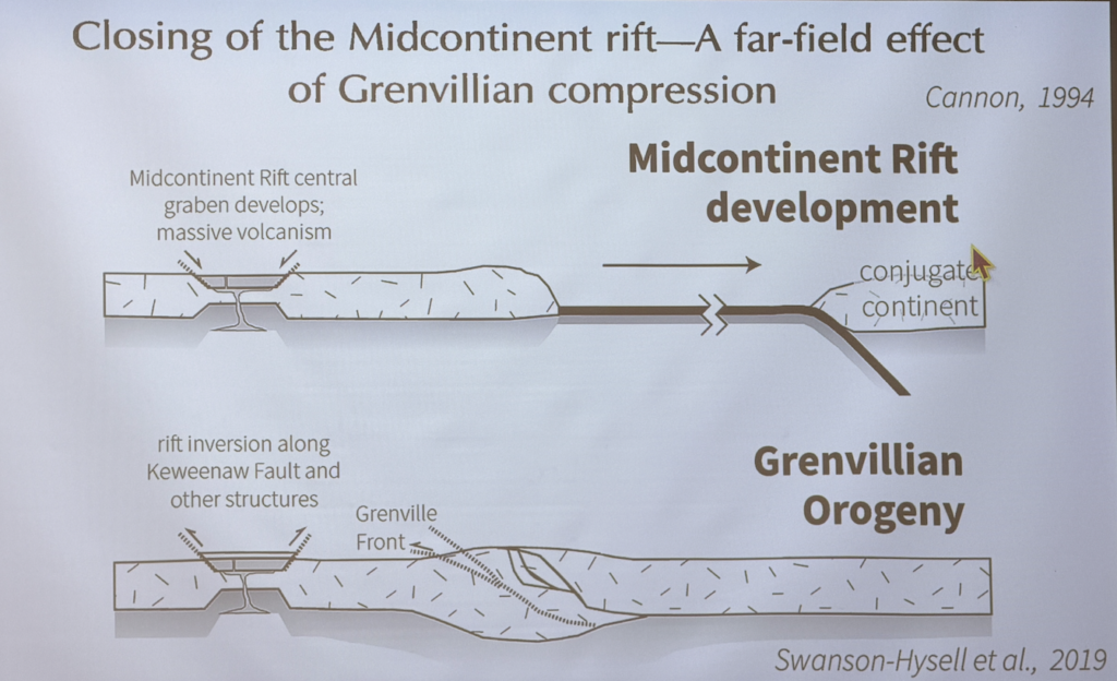
4.2. Rifting ended when Laurentia collided with Amazonia and Kalahari, forming the supercontinent Rodinia, and inverting the rift long the Keweenaw fault and other structures.
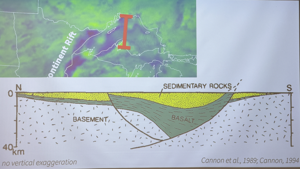
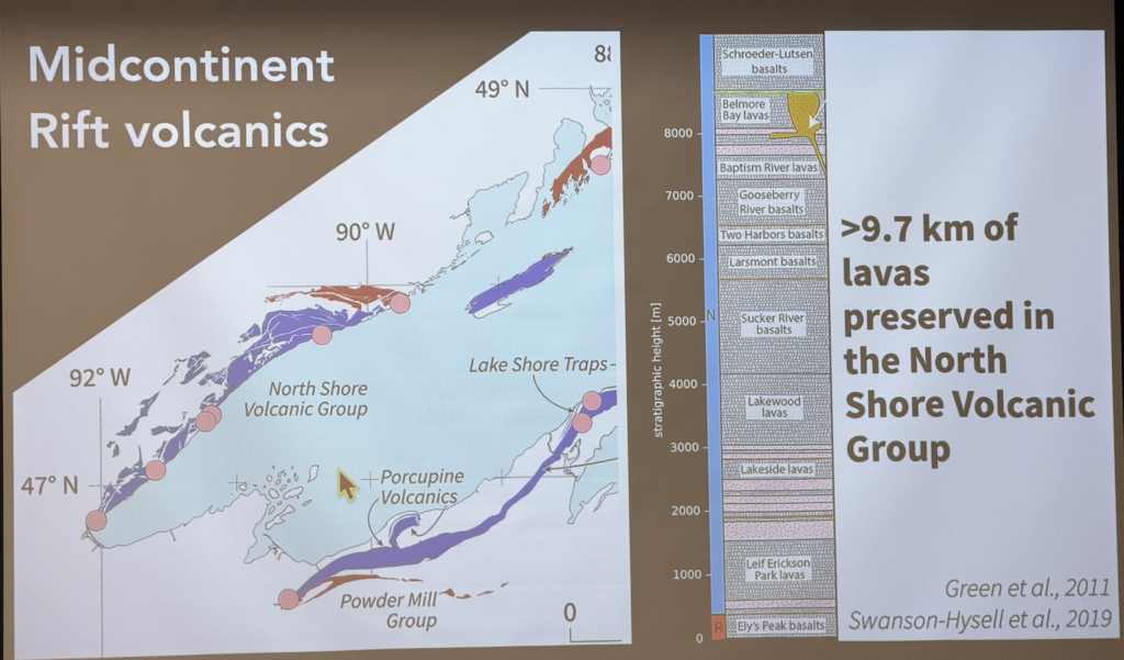
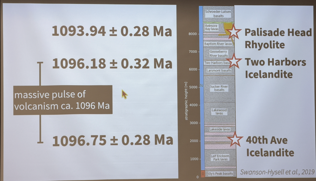
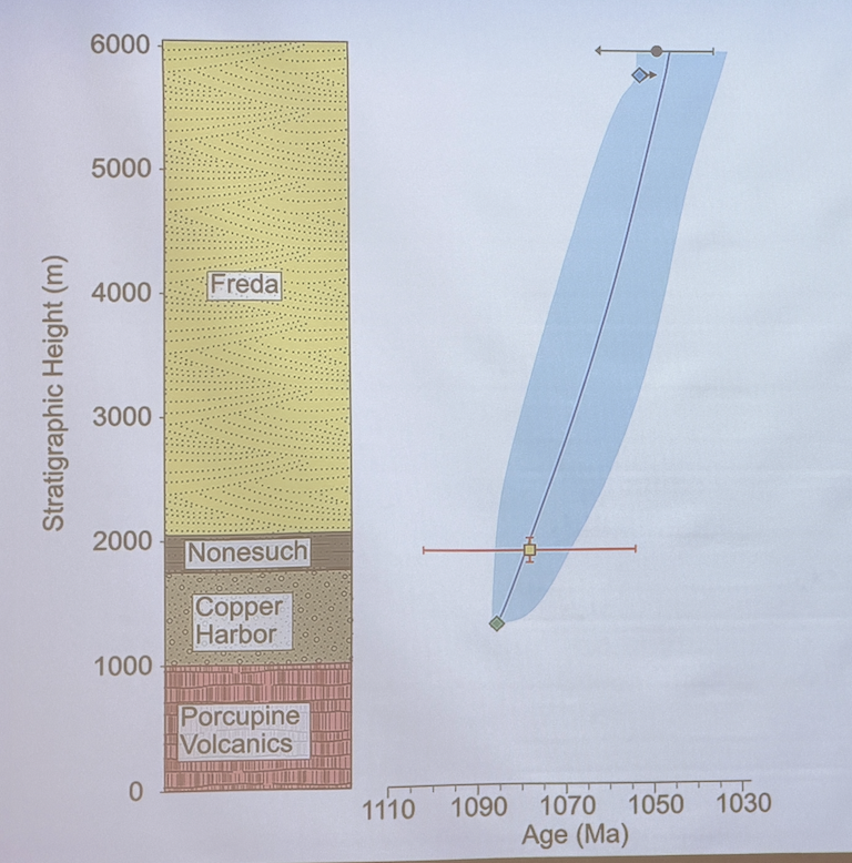
5. Details on the rifting
Huge pulse of volcanism during 600 Ka period.
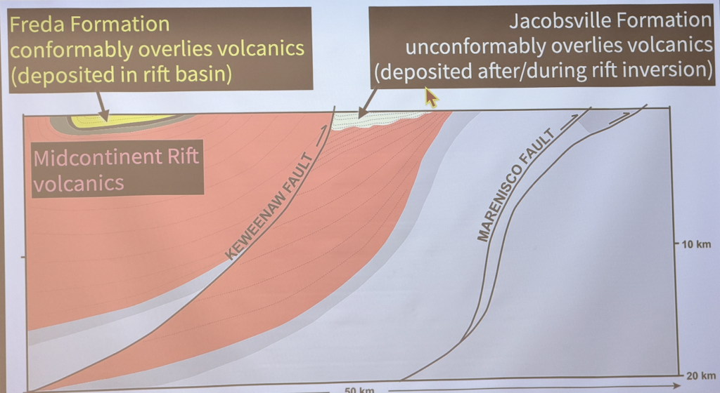
6. Details on the closing of the rift
7. A peek at the Keweenah
Views: 20